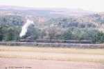


Mile Mark: 8.30
Elevation: 590'
Date: unknown
Published Photos: EBT 163, 171; AEBT 32
This low lying area was the greatest obstacle to the valley portion of the line. Initially it was crossed by a long trestle. As railroad and furnace operations produced cinder and slag, those materials were used to fill the trestle in. The timber remains still lie under the fill. This fill is a favorite excursion era photo op, from the hills to the east and northeast as well as from the Runk Road bridge over Aughwick Creek.
Map Links
Link to MyTopo map of this feature
Back to Runk Road Bridge |
Click on an image to see larger version | Forward to McMullins Summit |
||
|---|---|---|---|---|
| Up to Shirleysburg to Rockhill Furnace | ||||
| Tour Entry | Tour Index | Tour Info | ||