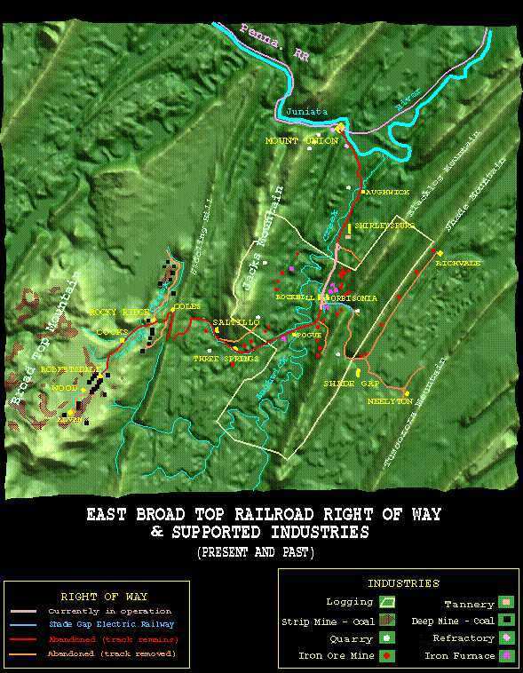
Welcome to the East Broad Top Railroad Virtual Tour. In the tour you can click from one point on the railroad to the next geograpically along the line, jumping from one significant point on the line to the next. You can travel the entire length of the line (not just the operating portion), divert down the branch lines, or at any point jump back up to an area of the line. Each site page provides data, history, disposition, and often plans and photographs of the site. Using the clickable image maps you can zoom into any particular area and site on the line. Step into the East Broad Top National Historic Landmark and enjoy your tour.
HAER info at the Library of Congess site>

Up to the EBT Homepage |
Click on any part of the map to see more detail of that area of the East Broad Top, or see each with the Forward button | Forward to EBT: Mount Union to Shirleysburg |
||
|---|---|---|---|---|
| As you pass through the tour, you can return to the higher levels using the links here. | ||||
| Tour Entry | Tour Index | Tour Info | ||