
Mile Mark: 14.60
Elevation: 657'
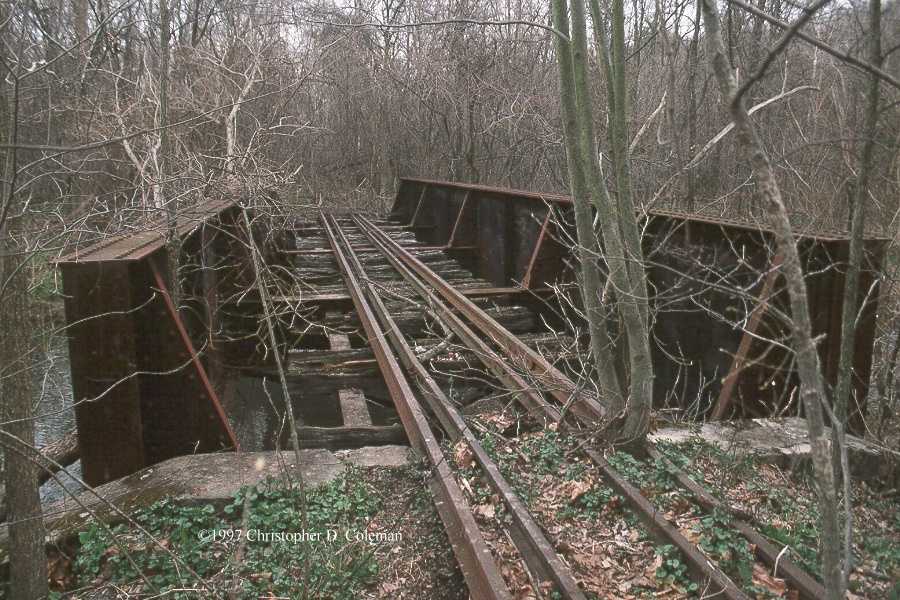
Date Built: ca. 1915
This is the location of the original 1874 bridge #8. It was 75' and most likely wood. The bridge was not damaged by the 1889 flood. The bridge was renumbered to #7 by 1917.
The current through plate girder bridge was built around 1915. Its single 50' span crosses Three Springs Creek for the first of three times. It's similar in design to Three Springs and Robertsdale Bridges. The location of this bridge has been identified as Prices Siding, though no evidence of a siding has been found.
The bridge is clearly visible from the Spring Creek Road, accessible by departing 994 at Pogue onto Sugar Grove Road. It can be accessed by walking along the edge of the creek, but it does border on a residential lawn.
There is a benchmark on or near the bridge for 657 feet elevation.
Map Links
Link to MyTopo map of this feature
Back to Pogue Passenger Shelter |
Click on an image to see larger version | Forward to Kyler's Bridge |
||
|---|---|---|---|---|
| Up to EBT: Rockhill Furnace to Saltillo | ||||
| Tour Entry | Tour Index | Tour Info | ||