

Mile Mark: 13.55
Elevation: 660'
Date Built: 1904
Published Photos: EBT 71, 154, 160, 198, 199
This is the location of the original 1874 bridge #7, known as Upper Aughwick. It included a 200' bridge and long approach trestle to the south. The bridge was undamaged by the flood of 1889, but the approach trestle was washed away. The bridge was renumbered to #6 by 1917.
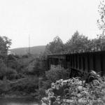
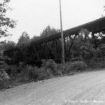
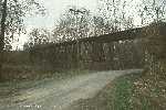
The current bridge was built by the American Bridge Company of Philadelphia in the fall of 1904 and erected December 25th. It replaced a trestle at this location which had been damaged during the January and March ice thaws on Aughwick Creek. The wood trestle to the south remained in place until 1911, when it was replaced by the current long fill. When the wood trestle was in place, Three Springs Creek flowed under it before emptying into Aughwick Creek east of the bridge. Sometime between 1904 and 1911 the creek bed was moved to flow west of the bridge and into Aughwick Creek. There is still a wet depression east of the fill that was once the creek bed. This point marks the beginning of the ascent of the valley of Three Springs Creek. The bridge consists of two 104' deck Warren truss spans and one 60' deck girder span for a total of 268'. It rests on two stone piers and stone north abutment likely dating from the 1880's. The south abutment, likely built in 1904 and enlarged in 1911, is concrete. It is the highest and longest bridge on the line.
Though most of its ties have rotted away the bridge stands intact. Its piers, though, are badly spalled and have been battered by the two major floods from Hurricane Agnes in 1972 and Fran in September 1996. Fran deposited the tree which currently resides in the middle span trusses.
On the EBT Most Endangered List
Map Links
Link to MyTopo map of this feature
Back to SHC High School |
Click on an image to see larger version | Forward to Pogue |
||
|---|---|---|---|---|
| Up to EBT: Rockhill Furnace to Saltillo | ||||
| Tour Entry | Tour Index | Tour Info | ||