
Mile Mark: 2.70
Elevation: 620'
Date Built: 1872
Published Photos: EBT 80
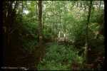
This northmost high point on the line and skirts the west side of Huling Ridge, and passes from the Juniata River Valley to the north to the Aughwick Creek Valley to the south.
This was at one time the location of one of the EBT's road overpasses, but seems to have been removed sometime before the end of operations.
Map Links
Link to MyTopo map of this feature
Back to Adams Passing Siding |
Click on an image to see larger version | Forward to Aughwick Mills |
||
|---|---|---|---|---|
| Up to EBT: Mount Union to Shirleysburg | ||||
| Tour Entry | Tour Index | Tour Info | ||